
Reading Clouds and Barometer in the Field
By Michael FaginEverest Basecamp, Mt. Everest WeatherReading Clouds and Barometer in the Field High-tech radars, satellites and computers aren’t necessary to get a general feel of the weather. Analyzing cloud development and reading a barometer on site can yield several clues that can be used to build a near-term forecast.
Evangelista Torricelli invented the barometer in 1643. One of his earlier models is storied to have been placed in a village square but it was removed because the townsfolk didn’t appreciate that bad weather manifested after the level in the barometer dropped. After developing an operable portable mercury barometer, he took it to the top of a mountain and recorded a lower pressure. This measurement is Sited as the first scientific evidence that the atmosphere doesn’t extend forever.
Using a barometer while traveling is tricky, mainly because of changes in altitude. In this instance, an above sea-level barometer reading correction Calculator may be useful. For greater accuracy, it is best to remain stationary for half a day. If the pressure reads 6 millibars (.177 inches of Mercury) lower than the night before and the cloud deck is a couple hundred feet higher, this likely indicates an incoming surface low that may bring clouds and precipitation. A higher cloud deck indicates a loosening of the compression of the atmosphere, documented as a slight Drop in air pressure. A shortcoming of measuring with a barometer at ground level is that it can’t record upper-level pressure changes and weather systems. Thus I have seen several times when a deep upper level low is moving in and there is not any change in the barometer but a big chance in the weather is about to occur.
Observed Wind Direction is critical in forecasting incoming weather. When Mt. Everest experiences a south to southeast wind, it often brings moisture from the Bay of Bengal and the surrounding Indian Ocean. North to northwest winds typically bring air that’s more compressed and drier weather. That, however, may push the jet stream farther southward than its typical positioning, which can intensify winds. At Mt. Rainier, winds from the south to southwest blow in the most precipitation and dry, northerly winds typically mitigate the formation of inclement weather.
Observing clouds is a great tool in weather forecasting in the field. When we have an area of low pressure that is starting to move in this is a typical cloud progression that we get. First we get a band of high cirrus clouds moving in.  If low pressure system is coming closer, more cirrus clouds are witnessed, along with a drop in barometric pressure than greater chance of some wet weather moving in during next 24 to 36 hours.
 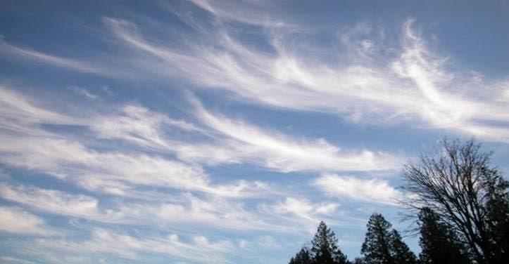 Mare’s tails are signs that upper-level winds are strong and the jet stream is likely approaching
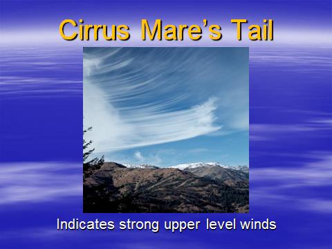
As the weather system and area of low pressure gets closer we continue to get the clouds moving in and the cirrus will bring a halo around the sun or the moon. 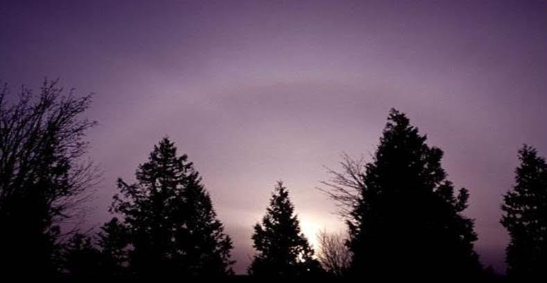 After the transition into stratocumulus and surface pressure falls, lenticular clouds may form, indicating precipitation will likely arrive within 24 hours,
 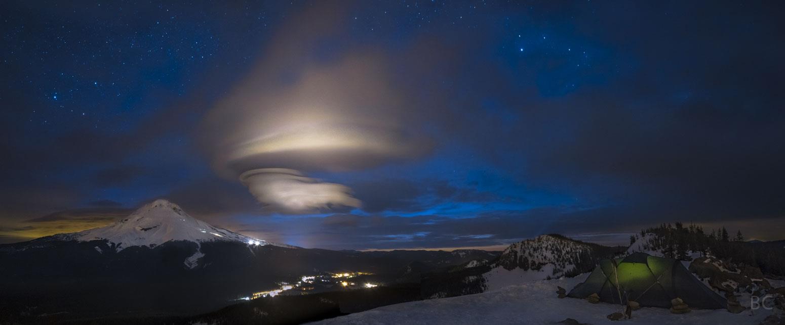 This image credit and copyright Ben Canales. Special thanks to NASA.
How accurate is the saying “Red sky at night, sailor’s delight. Red sky in morning, sailor take warning?” When the sun is near the horizon, water vapor and dust separate light in a manner that favors the colors near red. In the Northern Hemisphere, a red sky at night indicates a high concentration of dust particles, high pressure and stability. A red sky in the morning indicates a zone of high pressure has already passed and a Low is likely on its way. A fiery red sky is witnessed when the air has a high water vapor content and indicates rain may be on its way. The old adage loses its efficacy in the mountains, near cities and if it’s hazy from pollution or dust sent aloft by man or natural disasters. This photo was taken along the Oregon Coast (US) and captures some of the particles from a forest fire in the region. 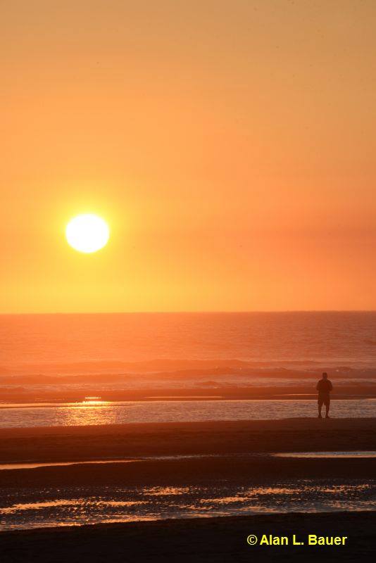
Article written by Meteorologist Geoff Linsley